Hobuck Beach and Shi Shi Beach Await Your Discovery
There are several ways to access the Neah Bay beaches on the Makah Reservation. The most popular one that visitors enjoy is Hobuck Beach. Some require a scenic hike through the rainforest, over cantilever bridges and along board walks like Shi Shi Beach. There are also beaches lining Neah Bay itself on either side of the Makah Marina parallel to Bay View Avenue, the scenic main road through town. A Makah Recreation Pass is required to park at the beaches. Please view our Recreation Permit page for more info.
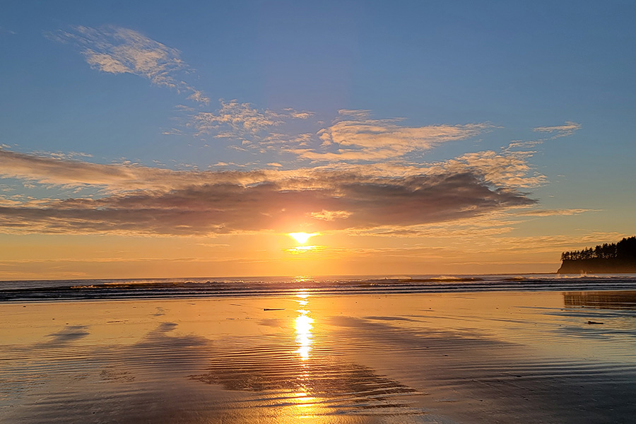
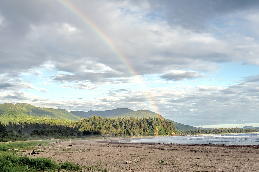
Hobuck Beach
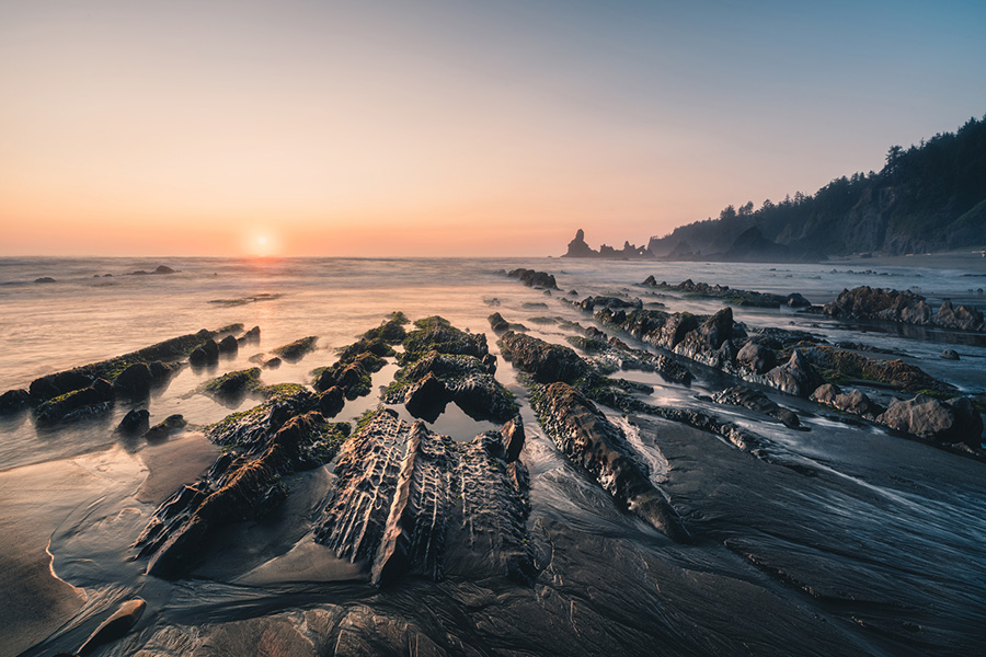
Located on the Pacific Ocean on the west side of the Makah Reservation, Hobuck Beach offers walking, birding, surfing, camping, swimming, and much more. Find a place to sit among the driftwood washed up on the shore to enjoy the view as the sun sets. Consult the National Buoy Data Center for information on swells and the wind directions for surf conditions. There is ample parking with access to restroom facilities for day visitors. For those longer stays, you are welcome to make a reservation at the Hobuck Beach Resort.
Hobuck Beach Events: Several events are hosted annually at Hobuck Beach including the Hobuck Hoedown and youth surf camps. The Hobuck Hoedown is a surf paddling festival with competitions, dinner, t-shirts and international participants. In contrast, the Photosynthesis Festival provides a cross section of underground artists from the Pacific Northwest, dancing, and workshops.
Directions: Travel through town heading west along Bayview Avenue for approximately 1 mile (follow the yellow lines on the pavement). The road will curve left onto Fort Street and then you will take a sharp right onto 3rd Avenue. Continue past the Sophie Trettevick Indian Health Clinic for approximately 350 feet then turn left onto Cape Flattery Road. After approximately 2.5 miles, turn left onto Hobuck Road and cross the Wa’atch River bridge. At the intersection after the bridge, go straight to access the day parking or turn sharp right to access Hobuck Beach Resort.
Click images to view them larger.
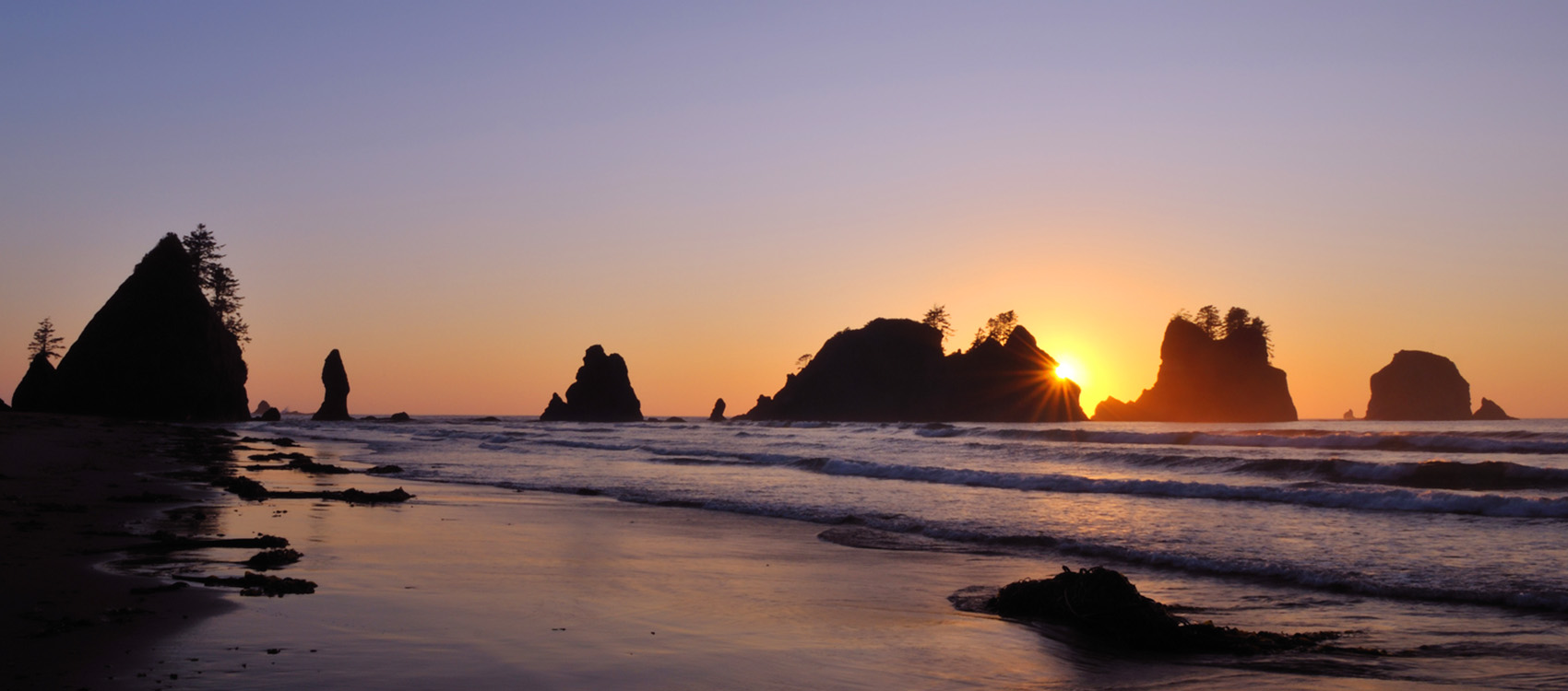
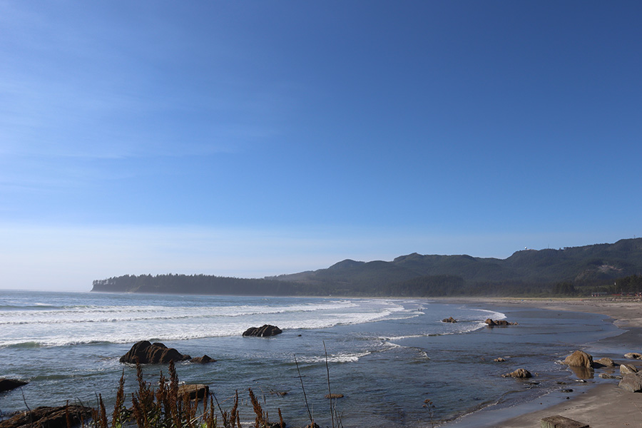
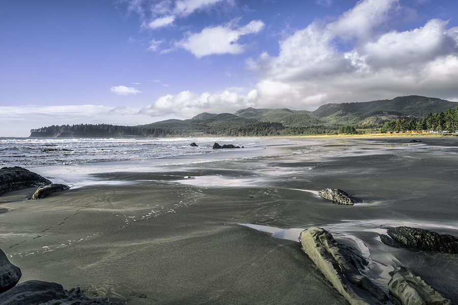
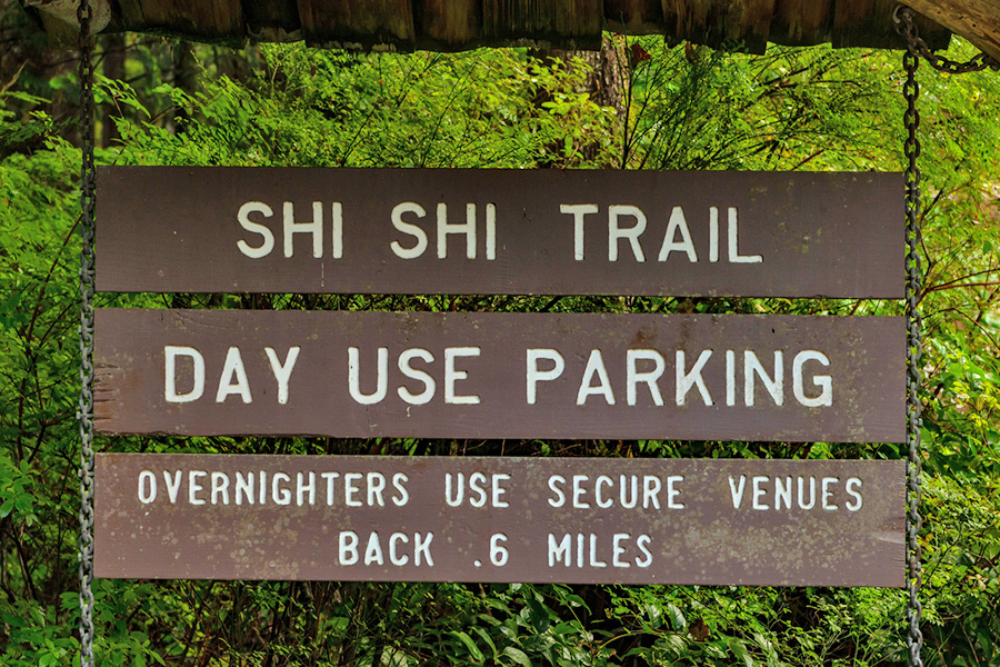
Shi Shi Beach
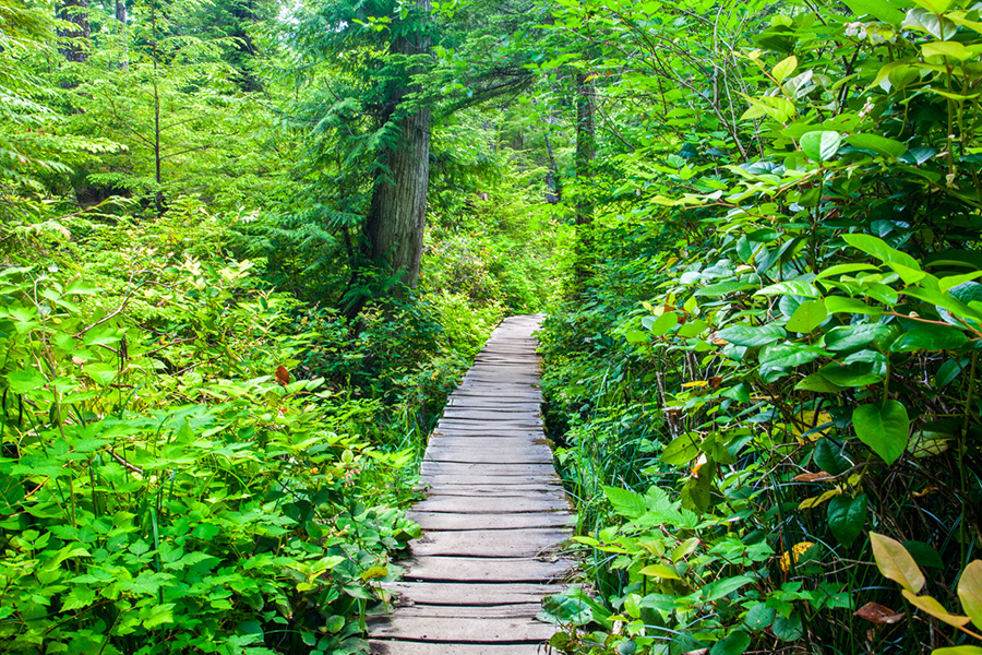
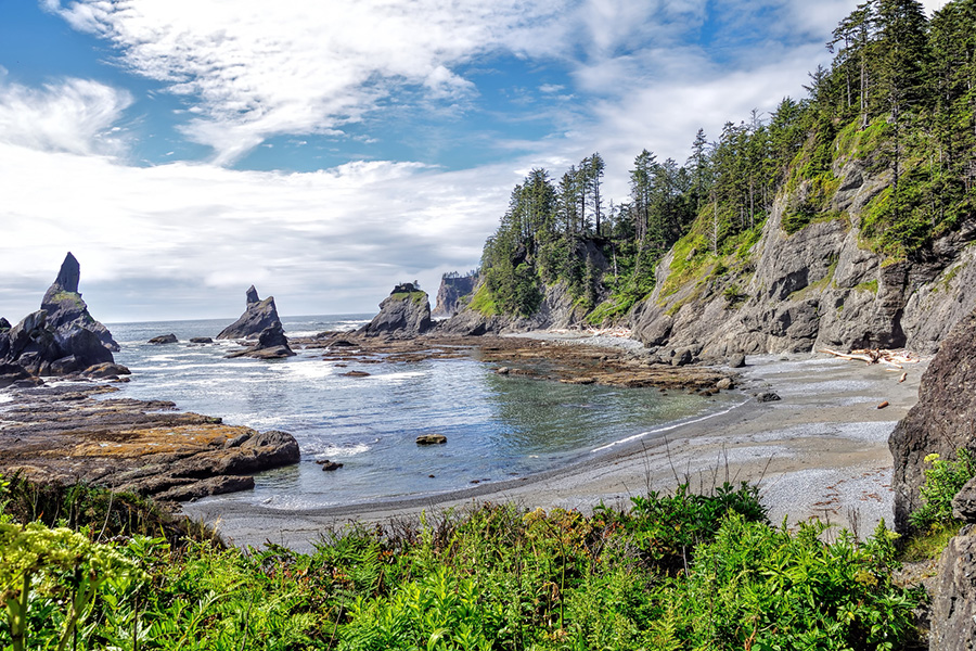
Visitors arrive from all over the world to enjoy the adventure of Shi Shi Beach. The trail consists of a great mix of rainforest hiking and beach walking. Make this an easy day hike or enjoy it as a backpacking trip with a night out on the beach. It is also possible to continue along the beach and hook up with the Ozette Loop hike or on to Hole in the Wall near La Push at Rialto Beach. There are many options but make sure you carry a tide chart with you so that you don’t get isolated by high tides at the headwalls if you plan to continue south past the Point of Arches. For information regarding the area along the beach designated as National Park please consult the website.
Shi Shi Beach Trail:
- 2 miles from the parking area to the beach
- 2.5 miles from the end of the trail along the beach to the Point of Arches
- Point of Interest – General M.C. Meigs Shipwreck
Amenities:
- Restrooms – located at the trailhead and designated locations along the beach
- Day use parking is located at the trailhead
- For overnight parking go back towards Neah Bay approximately one mile and access the private, paid parking across from Tsoo-Yess Beach
- There is no RV parking available
Difficulty: The trail through the forest to the beach is slightly undulating but has no significant gain in elevation. Expect mud, bridges and boardwalks that may be slippery. The trail is well maintained and navigation is easy.
Pets: Pets are permitted along the trail but are not permitted past the National Park Boundary after 1.7 miles.
Directions: Travel through town heading west on Bayview Ave for approx 1 mile (follow yellow lines on the pavement). The road will curve left onto Fort St and then you will take a right onto 3rd Ave. Continue past the Sophie Trettevick Indian Health Clinic for approx 350 feet then turn left onto Cape Flattery Road. After approx 2.5 miles, turn left onto Hobuck Rd and cross the Wa’atch River bridge. At the intersection after the bridge, go straight on Hobuck Rd for just under a mile, then take a slight right onto Fam Camp Rd. At the stop sign, turn left onto Makah Passage and follow for .8 miles, then take a slight right onto Tsoo-Yess Beach Rd. After 2 miles, follow the road left onto Fish Hatchery Rd. The trailhead will be approximately 0.2 miles down the road on the right.
Click images to view them larger.